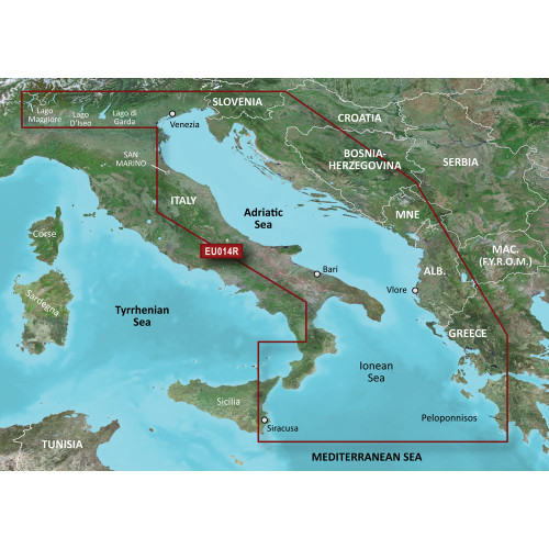
Garmin - BlueChart® g3 HD - HXEU014R - Italy Adriatic Sea - microSD™/SD™
-
Perfet Fit, Guaranteed
Get the right part every time
-
Expert Support
Our in-house specialists know our products inside and out
-
Enhanced Value & Service
We go beyond the sale with professional and balanced services
-
Wordwide Delivery
Enjoy hassle-free worldwide delivery
Unveil the Depths: The BlueChart® g3 HD HXEU014R Coastal Chart for Italy & Adriatic Sea
Chart Your Own Course: A Comprehensive Guide
Navigating the Adriatic Sea just became a whole lot easier. With the BlueChart® g3 HD HXEU014R, you get unparalleled coverage from Italy's Lago Maggiore down to Greece's Gulf of Arcadia. You'll never have to doubt your charts again, thanks to the integrated Garmin and Navionics® data. Plus, our Auto Guidance¹ technology can plot your path based on depth and overhead clearance. It's navigation like you've never experienced.
Smooth Sailing: The Tech Behind The Chart
With features like Depth Range Shading, you can easily visualize up to 10 different depth ranges at a glance. Enjoy up to 1-foot contours for more accurate underwater topography. And when you need a second opinion, the free ActiveCaptain® app offers downloadable NOAA raster cartography for extra peace of mind.
Fit to Navigate: Size and Scalability
The BlueChart® g3 HD is available as a microSD™/SD™ card, ensuring it is compatible with a wide range of devices. The compact size ensures it won't take up much room, making it an unobtrusive addition to your navigational toolkit.
Points of Interest: What Makes It Exceptional
- Offers full coverage of the Adriatic Sea, from Italy to Greece
- Integrates Garmin and Navionics® data for superior detail and clarity
- Auto Guidance¹ technology for intelligent routing
- Depth Range Shading for easy depth identification
- Free downloadable NOAA raster cartography via the ActiveCaptain® app
We ship all in-store (FL) stock orders the same day if placed before 3 PM EST, Monday through Friday. Orders placed after this time will ship the next business day. Orders fulfilled from other warehouses or manufacturers may not ship the same day. If an item is out of stock, we will notify you promptly.


