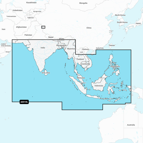
Garmin - Navionics+ Electronic Chart - NSAE020R, South China & Andaman Seas, Marine Chart
-
Perfect Fit, Guaranteed
Get the right part every time
-
Expert Support
Our in-house specialists know our products inside and out
-
Enhanced Value & Service
We go beyond the sale with professional and balanced services
-
Wordwide Delivery
Enjoy hassle-free worldwide delivery
Unveil the Secrets of South China & Andaman Seas with Navionics+ NSAE020R
Introducing Navionics+ NSAE020R, the pinnacle of marine mapping solutions that offers an unparalleled chartplotting experience. Chart your courses through the vivid landscapes of the South China and Andaman Seas like never before!
Unleash the Cartographer in You
Navionics+ NSAE020R is more than just a marine chart; it's a robust blend of Garmin and Navionics technology. With high-resolution depth shading, you get a detailed and vivid display of the underwater world.
Why Navionics+ NSAE020R Is Your Ultimate Nautical Companion
- All-in-One Mapping: A comprehensive blend of coastal, lake, and river features.
- Dynamic Updates: Keep your charts up-to-date with daily enhancements via the ActiveCaptain app.
- Advanced Auto Guidance+: Benefit from the union of Garmin and Navionics automatic routing for a smoother sailing experience.
- Depth Range Customization: Easily select and view up to 10 color-shaded depth ranges.
- Community-Centric: Access valuable points of interest through the ActiveCaptain Community.
We ship all in-store (FL) stock orders the same day if placed before 3 PM EST, Monday through Friday. Orders placed after this time will ship the next business day. Orders fulfilled from other warehouses or manufacturers may not ship the same day. If an item is out of stock, we will notify you promptly.


